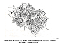
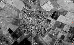
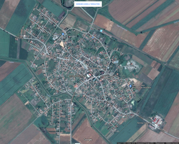
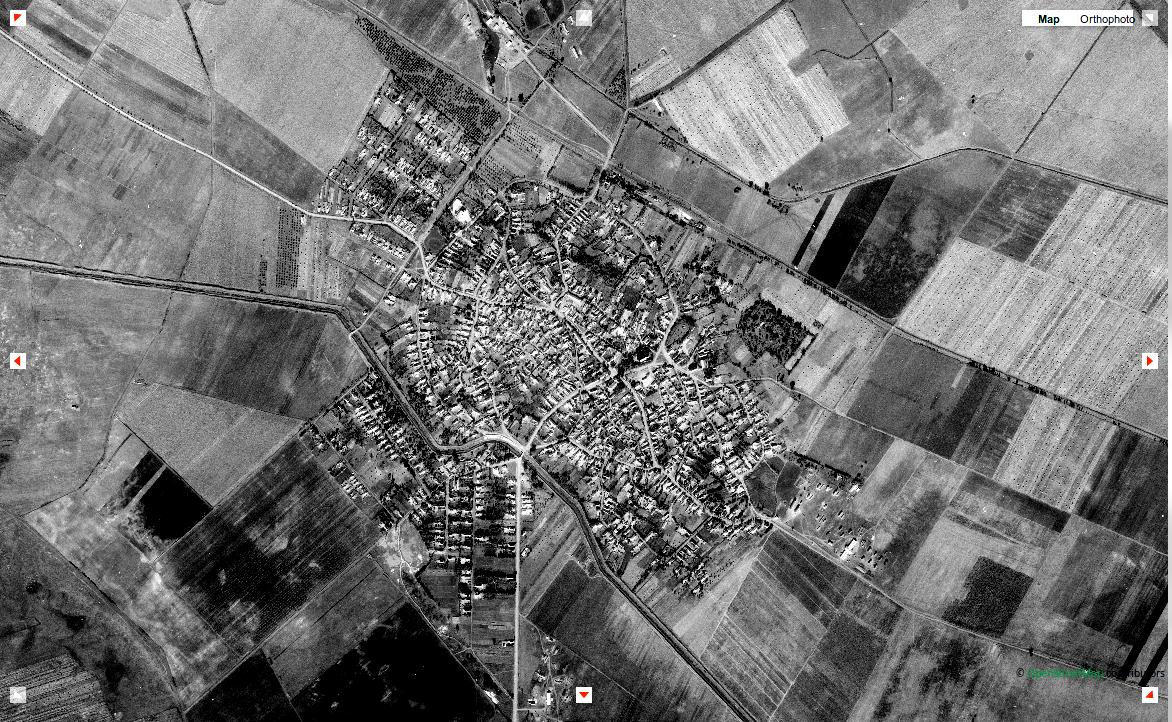
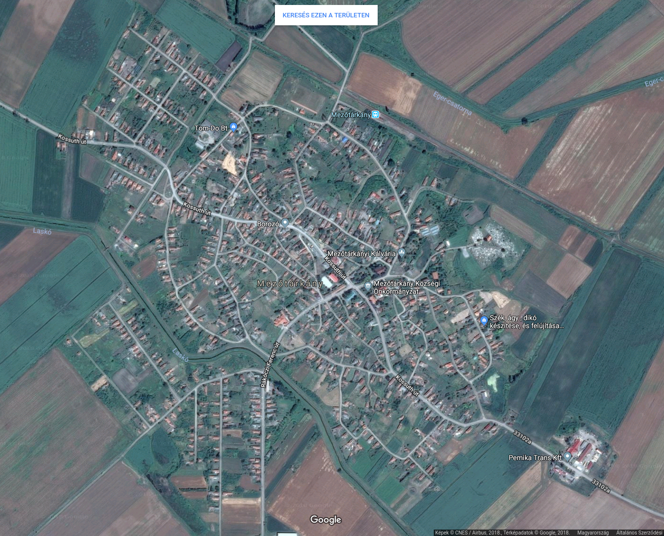
Mezőtárkány is an 850+ years old settlement on the edge of the Great Hungarian Plain (first appearance in documents is from 1279). Her layout is a variation of the clustered settlement pattern, here it's called something like "double-plot-cluster" type. It's a typical Hungarian layout tho I can imagine to occur in other countries with notable steppe type landscape as it derived from the nature of horse herders. Steppe people aren't really nomads as nomads live the same lifestyle all year long, with the change of the seasons they only change their habitat and not their habits. Nomads move either along a north-south axis so they can enjoy the same weather both summer and winter, or along the elevation for the same reason. Wherever and whenever they are they do the same animal related activities all year round. Steppe people on the other hand graze their livestock in the summer, they change pastures if need arises (which can lead to war and forcing other tribes to move) but these pastures are all in the same climate and then as winter comes they move to winter quarters along rivers - but which are in the same elevation and latitude - where they butcher the excess livestock and stay put during the whole winter feeding fodder to the animals. Then as spring comes they move out the pastures again. I think sometimes this is called half-nomadism but there's no exact definition. Not that I saw at least. So these "double-plot-cluster" layout is based on the winter quarters. The yurts were set up in random places (not necessarily in random order which might have been influenced by rank, prestige) but around a central open space and the animals were placed in the outer ring. If that particular place was used for a longer period (probably advantageous for harvesting and storing fodder for winter) then more permanent buildings were erected than yurts. Later in place of yurts they built houses on small plots in the inner cluster and pens, stables, barns in the outer circle. Ofc slowly the proportions of the animals changed, less horse, more swine, poultry, bovine, goat and sheep. So a family owned one plot in the middle for their residence and one plot in the outside circle for husbandry, hence the name "double-plot". The main roads - the herding lanes - of such settlements run radially from the center, and these roads were connected by ring of roads in a disorderly fashion. There was also a main ring which divided the nucleus and the outer circle. Sometimes this road had some fortification to increase safety. Later as the population grew and the economy changed and people relied less on their livestock for living the outer circle filled up with residences. I have three images of Mezőtárkány, a drawing from 1869, the aerial photo from 1964 (changed the contrast, sadly couldn't dl the original, so this is also just a screenshot), and the screenshot I made today.
 11/06/2018 (Tue) 22:18:29
No.20464
del
11/06/2018 (Tue) 22:18:29
No.20464
del